Coastal threats
Protect biodiversity with our AI mapping model: optimized environmental monitoring and natural heritage management
Protect biodiversity with our AI mapping model: optimized environmental monitoring and natural heritage management
Coastal threats are a key issue at i-Sea, where we have more than 20 years’ experience exploring the advantages offered by Earth Observation for mapping coastal dynamics and the health status of our beaches and coastlines. Satellite technology has more than one trick up its sleeve and is omnipotent when it comes to characterizing and monitoring coastline movement, changes in the bathymetry of shallow beds, offshore breaks, characterizing the evolution of sediment stocks, and assessing the vulnerability of coastal regions to coastal erosion.
Above all, it is a tool for gathering information that helps us understand the beach system in its entirety. This makes it a multi-scale diagnostics tool that offers not only a global view but also the ability to frequently update geomorphic and morphodynamic indicators for the status of beaches and the coastline, and therefore also a steering tool.
Over the years, i-Sea has developed and consolidated a range of services adapted to characterizing the position and movements of geomorphic indicators on coastlines using multi-resolution satellite images (Copernicus Sentinel-2, Pléiades and Spot constellations, etc.). The range offers the ability to address both local-scale issues—responding to the needs of coastal authorities—and global issues, to support the regions most vulnerable to adapt to climate change.
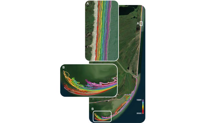
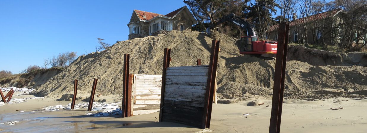
Our generic coastline product is a tool for monitoring the shoreline dynamics observed via the Sentinel-2 satellites, enabling rapid and global diagnostics of the coastline’s recent evolution. Our Sentinel-2 product’s leading features: worldwide cover and reproducibility Our detecting algorithm makes it possible to almost automatically extract indicators linked to average shoreline shifts and the shore’s position at the highest water point (hydrographic coastline), making it ideal for registering multimetric changes affecting shores that are particularly exposed to erosion (> 5 m/yr) and the sudden changes occurring during storms.
For many years, we used this product on a local scale working with very high resolution satellite images (Pléaides or Worldview depending on the geographic region), which offer even more accurate characterization, similar to the reality on the ground. These are favoured by local authorities and coastal stakeholders when detailed analysis is required.
The switch to characterizing coastal erosion threats was completed simply by compiling time sets of historic coastlines. At i-Sea, we are particularly interested in recent changes in coastlines within the context of the climate emergency and the likely acceleration of its impact on shores. Our Sentinel-2 product’s leading features: worldwide cover and reproducibility
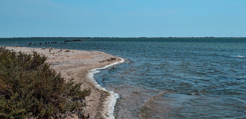
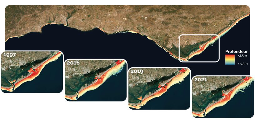
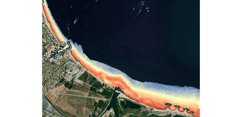
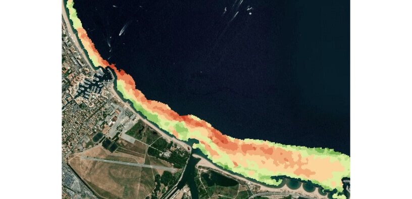
Satellite-Derived Bathymetry (SDB) is a technique for collecting coastal bathymetric data via satellite remote sensing which is used by various hydrographic agencies (such as the SHOM in France) to develop and update hydrographic marine maps in difficult-to-reach and highly dynamic locations.
For many years, i-Sea has used this approach for two particularly operational purposes:
1. To complete an initial summary of the bathymetry of shallow beds (0-20 m deep) to fill in missing information from the bathymetric data available on the shore. This technique, based on water colour algorithms, can be used to generate high-resolution bathymetric DTMs (Pléaides 2 m/Sentinel-2 10 m) with submetric vertical accuracy suitable for the data input needs of modelling coastal hydrodynamics.
2. To characterize the bathymetric evolution of shallow beds in order to learn about hydro-sedimentary and morphodynamic processes affecting beaches and ultimately for managing sediments and coastal erosion.
i-Sea’s expertise was recognized with an award at the GMES Masters 2012 for its BALIST dual optical/radar bathymetry service. Operationally, i-Sea primarily uses the so-called optical approach, based on water colour algorithms, which works very well for shores moderately exposed to wave agitation and low turbidity.
We continue to make progress in R&D to maximize the applications of satellite bathymetry and its benefits for the coastal community.
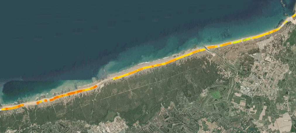
Products for understanding coastal dynamics and shallow bed bathymetry are used to characterize coastal erosion threats.
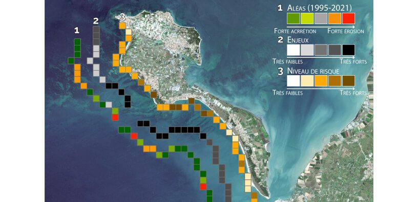
This, coupled with the characterization of issues, can be used to assess a shore’s vulnerability or risk of exposure to coastal erosion. This is the most recent level of our Space for Shore service, equipping local authorities and government departments with the most up-to-date information possible on the vulnerability of coastal towns to erosion.
i-Sea participe en Guyane aux actions d’observation de la dynamique des bancs de vase pour le compte de l’Observatoire de la Dynamique Côtière (l’ODyC) piloté par la Préfecture de Guyane et le BRGM.
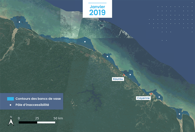
In French Guiana, i-Sea is involved in various actions to observe mud bank dynamics on behalf of the Observatoire de la Dynamique Côtière (Coastal Dynamics Observatory/ODyC), under the steering of the Guiana Prefecture and the Bureau de Recherches Géologiques et Minières (Geological and Mine Research Office/BRGM).
Scientists in French Guiana have long used satellite remote sensing for this purpose, as in the 2010-2012 INFOLITTORAL project, for example, which i-Sea’s founders were also involved in. In 2020, the Copernicus Challenge (FPCUP EU-funded/Caroline Herschel, CNES steering) triggered the launch of mud bank surveillance, which has continued in a partnership between i-Sea and the French Guiana’s BRGM.
i-Sea has directed the European Space Agency’s ESA Coastal Erosion programme since 2019.
This ESA/EOEP-5 backed project has made it possible to mature products from i-Sea and its partners, and to create prototypes for a range of services tackling coastal erosion for six member countries (France, Germany, Norway, Portugal, Greece and Romania).
• A retrospective over more than 25 years produced from satellite archives;
• 4,500 km of European coastlines covered;
• More than 50 organizations brought together in the Space for Shore community.
See all the results and deliverables from the ESA Coastal Erosion programme here.
Explore our tailor-made solutions combining environmental expertise and advanced technologies to meet your specific challenges
Contact us