Biodiversity
Protect biodiversity with our AI mapping model: optimized environmental monitoring and natural heritage management
Protect biodiversity with our AI mapping model: optimized environmental monitoring and natural heritage management
Our services address the key issues in biodiversity, offering assistance for the implementation of public policies designed to promote biodiversity and support the climate and environmental transition.
Created to meet the regulatory need for vegetation mapping and monitoring of developments in Natura 2000 natural spaces, our services cover a wide range of needs related to initial characterization and environmental modelling, on every scale. Combining artificial intelligence and satellite technology creates an endless list of possible applications for biodiversity issues!

L’outil satellitaire fournit un état des lieux précis et actualisé des différents types de végétations et d’habitats naturels.

Utilisez le Machine Learning pour combiner l’imagerie satellitaire à l’expertise terrain, modernisant ainsi votre cartographie.

L’outil satellitaire est polyvalent, adapté à des projets de cartographie locaux comme nationaux, facilitant ainsi la gestion de la biodiversité.
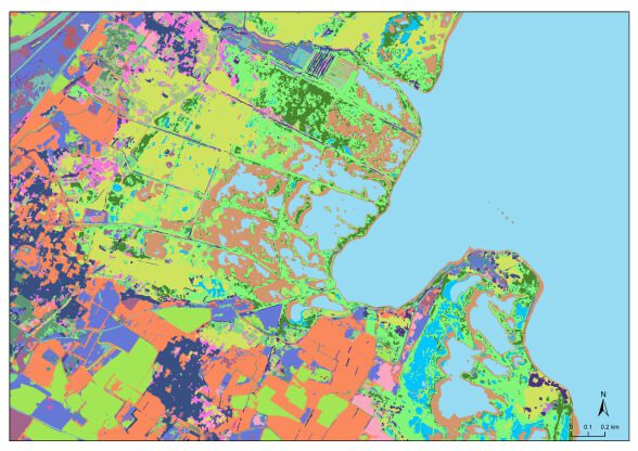
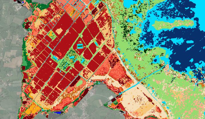
The main advantage of satellite imaging is its ability to provide comprehensive, real-time information on the types of vegetation and natural habitats that make up the rich ecosystems in our regions. This means going beyond simply determining the level of vegetation in regions (presence/absence of vegetation) and instead being able to carry out an ecological inventory that characterizes plant communities.
Digital technology with semi-automated processing methods based on approaches such as machine learning combined with maximum use of satellite imaging and expert on-the-ground observations is modernizing the way mapping projects are designed. Satellites can be used for both local-scale mapping projects (just a few km 2 for a listed site) and the large-scale regional and national projects mapping via satellite remote sensing was originally designed for.
Employing satellite technology for projects to map plant biodiversity means taking a modern approach to mapping to increase knowledge, monitor vegetation dynamics, and steer and assess government policies designed to increase biodiversity.
Biocoast is a vegetation and natural habitat mapping service designed by i-Sea’s R&D teams and released in 2018. Requested by key stakeholders in biodiversity, including the French Office for Biodiversity (OFB), the Conservatoire du Littoral, and the Seine Estuary and Arès Lège Cap Ferret Saltmarsh nature reserves, who became early adopters in 2017, it offers a modern solution for advanced vegetation mapping and can be used for very high-resolution ecological characterization of natural environments and urban natural environments, offering a quality of observation that rivals on-the-ground data. Initially a prototype for natural coastal environments and the result of the team’s 15+ years of experience in the mapping of coastal marine environments (which explains the name), Biocoast is a flexible, turnkey solution that can be used in all types of environment, from coasts to the countryside, mountains and urban landscapes.
Our financial backers: Bpifrance, the French Office for Biodiversity (OFB), the Conservatoire du Littoral, and the Seine Estuary and Arès Lège Cap Ferret Saltmarsh nature reserves
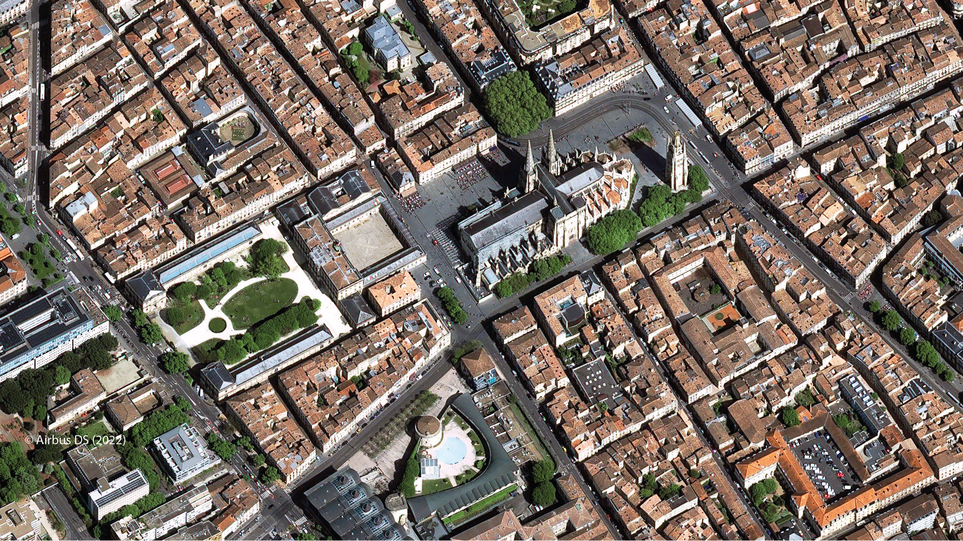
Biocoast met en œuvre un algorithme de Machine Learning exploitant en entrée des images satellite très haute résolution (Pléiades – 0,5 à 2 m de résolution) et des relevés de végétation de terrain permettant une cartographie avancée et très haute résolution du patrimoine naturel végétal. Le process de cartographie est semi-automatique permettant une cartographie rapide, actuelle et exempte de biais de photo-interprétation. La combinaison de la THR et de l’automatisation permet de réaliser un état écologique précis des groupements de végétation habitant nos espaces naturels, comme si on était sur le terrain ! Suivre leur trajectoire au fil des années devient aussi plus facile !
2018
Launch year
20
Number of productions
To meet the needs of biodiversity stakeholders, Biocoast is now available as an online app named Biocoast Online. This offers huge advances in autonomy, enabling anyone to get to grips with Biocoast technology and use it on a daily basis, updating and enriching their vegetation and habitat mapping according to their needs.
The Biocoast Online app receives funding from the France Relance “Space applications, an economic and corporate springboard” programme led by the CNES, as well as support from the Nouvelle Aquitaine Region.
As our biodiversity solutions were rolled out in urban landscapes, so came the need to support project promoters with a solution to help steer and track successes in urban revegetation and renaturing operations.
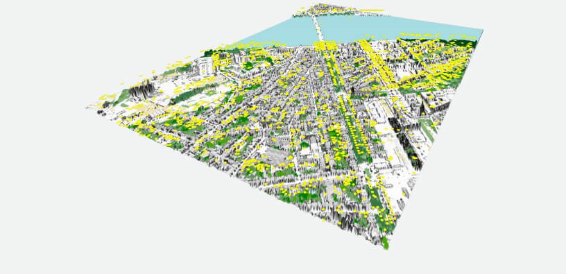
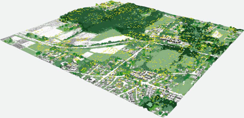
In partnership with Bordeaux Métropole, i-Sea has developed a tool for mapping arboreal heritage designed for both compiling an inventory of existing trees (counting the number of trees) and monitoring the young trees that have been planted (number and state of growth/health status), indicators that will be fed into a dashboard and used to measure the success of the metropolitan region’s revegetation programme.
The Trees in the City mapping solution uses two types of imaging—aerial and satellite—and is based on machine learning algorithms, combining the benefits of deep learning (automatic recognition of trees, young trees in particular) and our Biocoast product (characterization of the canopy’s health status).
2021
Launch year
1
Number of productions
RIVAGE/DREAL Occitanie syndicat mixte
“La méthode marche parfaitement bien sur les milieux ouverts” à propos des cartographies des sites Natura 2000 des étangs landais et médocains – Luc Albert et Alain Verot, DREAL NA
OFB Parc Marin Estuaire de la Gironde et de la Mer des Pertuis
“i-Sea a réalisé la cartographie de 3 grands habitats d’intérêt communautaire : les herbiers de zostères, le champs de macroalgues et de la végétation des prés salés. Le Parc Marin s’étend sur plus de 1300 km de littoral, on n’aurait pas pu le faire autrement” – Aurélie Dessier, Parc Marin EGMP
PNR Camargue/DREAL PACA
“On est très contentes du travail réalisé, c’est de qualité” – Mayder Sallefranque, service Patrimoine Naturel à la DREAL PACA
Bordeaux Métropole
Explore our tailor-made solutions combining environmental expertise and advanced technologies to meet your specific challenges
Contact us